Hi I am Onur Karaca...

a dedicated GIS and Remote Sensing Specialist with a strong focus on spatial analysis, geospatial modeling, and seismic interpretation. I leverage the full power of Geographic Information Systems (GIS) to map, model, and monitor Earth’s dynamic processes. From InSAR-based deformation analysis to hyperspectral water quality monitoring and seismic hazard mapping, I combine advanced GIS tools with satellite data and Python automation to deliver actionable insights for research and real-world applications

About Onur Karaca...

I was born and raised in Adana, Turkey, where I spent my early years through high school. My academic journey in Earth sciences began with a B.S. in Geophysics at Dokuz Eylul University in Izmir. I started my professional career working on land-based seismic acquisition projects at a petroleum company, gaining hands-on experience in subsurface exploration.

After that, I spent three years at Dokuz Eylul University’s Seismic Laboratory, where I worked on marine seismic surveys and multibeam bathymetry across various national research expeditions. These experiences deepened my interest in geophysical data and Earth observation.

In 2016, I was awarded a full scholarship by the Turkish Ministry of National Education to continue my education in the United States. This brought me to the University of Houston, where I completed my M.S. in Geology and began my Ph.D. in Earth and Atmospheric Sciences.

Most recently, I worked for four years at the Directorate General of Mineral Research and Exploration (MTA) as a GIS and Remote Sensing Expert. There, I focused on geospatial analysis, InSAR-based deformation monitoring, and environmental mapping using satellite imagery.

Today, I specialize in geospatial analysis, remote sensing, and seismic interpretation. My work integrates GIS, InSAR, hyperspectral imaging, and Python-based automation to better understand tectonic deformation, land subsidence, and water quality. Whether in the field, the lab, or behind the screen developing models, I’m passionate about transforming complex data into meaningful solutions.

Resume

Education

Ph.D. in Earth and Atmospheric Science (Geology) – University of Houston

✓ Graduate Teaching Assistant – GIS and Remote Sensing (Expected Completion: 2027)
M.S. in Earth and Atmospheric Science – University of Houston (2019-2021) – GPA: 3.67

✓ Thesis: Neotectonic Study of The Sibi Re-Entrant
M.S. in Geology – Cukurova University (2012-2015) – GPA: 4.00

✓ Thesis: Determination of Sweep Parameters by using Vibroseismic Source in Geothermal
M.S. in Geophysics – Dokuz Eylul University (2005-2011) – GPA: 76/1000

✓ Thesis: Determination of Sweep Parameters by using Vibroseismic Source in Geothermal

Professional Experience

Graduate Teaching Assistant 
University of Houston, Department of Earth and Atmospheric Sciences (2024-Present) 

ü   Instructed GIS and Remote Sensing courses, guiding students in ArcGIS Pro, spatial analysis, and geospatial workflows.

ü  Graded assignments, provided one-on-one tutoring, and contributed to coursework and lab material development.

ü  Supported students in spatial data analysis, geospatial modeling, and remote sensing image processing techniques.

ü  Collaborated on the Texas Water Development Project (TWDP), conducting advanced analysis of water quality using hyperspectral and multispectral imagery from ENMAP, PRISMA, Sentinel-2, Landsat-8, and drone-based sensors.

ü  Performed TSS (Total Suspended Solids) estimations using band ratios, machine learning algorithms, and regression models within platforms such as SNAP, ENVI, and Python-based tools.

ü  Developed automated workflows for satellite image preprocessing, classification, and index generation using custom Python scripts and ArcGIS tools. 

GIS & Remote Sensing Expert 
MTA – Directorate General of Mineral Research and Exploration Turkey (2021-2024)
 

ü  Developed geological and thematic maps using ArcGIS Pro, including digitizing, georeferencing, and advanced spatial analysis.

ü    Conducted deformation assessments using InSAR (Sentinel-1, ALOS-PALSAR) data for tectonic and ground stability studies.

ü  Integrated remote sensing data with GIS to support environmental monitoring and mineral resource assessments.

ü  Automated complex geospatial workflows by developing custom Python tools and scripts using ArcPy, significantly improving processing efficiency.

ü  Designed and implemented tailored GIS solutions with ModelBuilder and Python, enabling repeatable and scalable spatial analysis.

Research Scientist
University of Houston (2020-2021)
ü Processed InSAR (SBAS-PS-Sentinel-1), GPS, and seismic data for the Brazil Braskem Project.
ü  Conducted structural deformation analysis using remote sensing techniques.
 

Marine Geophysicist

Dokuz Eylul University, Seismic Laboratory (2015-2017)
Conducted 2D sparker seismic and multibeam bathymetry data acquisition during marine surveys.

Participated in the Black Sea Natural Gas Hydrate Project and TÜBİTAK-funded research initiatives.

Processed and interpreted seismic data using Kingdom Suite, Petrel, and ProMax.

Performed continuous seismic surveys, including equipment setup, testing (daily/monthly), and troubleshooting.

Handled marine seismic equipment maintenance and repair.

Operated workboats to support survey activities.

Assisted the Chief Observer in preparing detailed survey reports.


Geophysics Engineer / Junior Observer
Guney Yildizi Oil Production Co. (2013-2015)

ü  Monitored seismic acquisition systems (Sercel 428XL) to ensure high-quality data collection.

ü  Controlled Vibroseis source signal parameters during field operations.

ü  Operated and maintained all recording instruments, including parameter selection, troubleshooting, repair, and backups.

ü  Supervised line operations and personnel, including managing recording crews and mentoring junior staff.


Publications

2021-2022    Karaca, Sukru O., Ismail A. Abir, Shuhab D. Khan, Erman Ozsayın, and Kamil A. Qureshi. 2021. Neotectonics of the Western Suleiman Fold Belt, Pakistan: Evidence for Bookshelf Faulting Remote Sensing 13, no. 18: 3593. https://doi.org/10.3390/rs13183593


2022-2024      Karaca, Sukru O., Erten G., Yimaz B. and Ozalp S., 2023. DInSAR analysis and geophysical modeling of 2022 November 23 Gölyaka-Düzce Earthquake, Turkish Journal of Earth Sciences (https://doi.org/10.55730/1300-0985.1906).


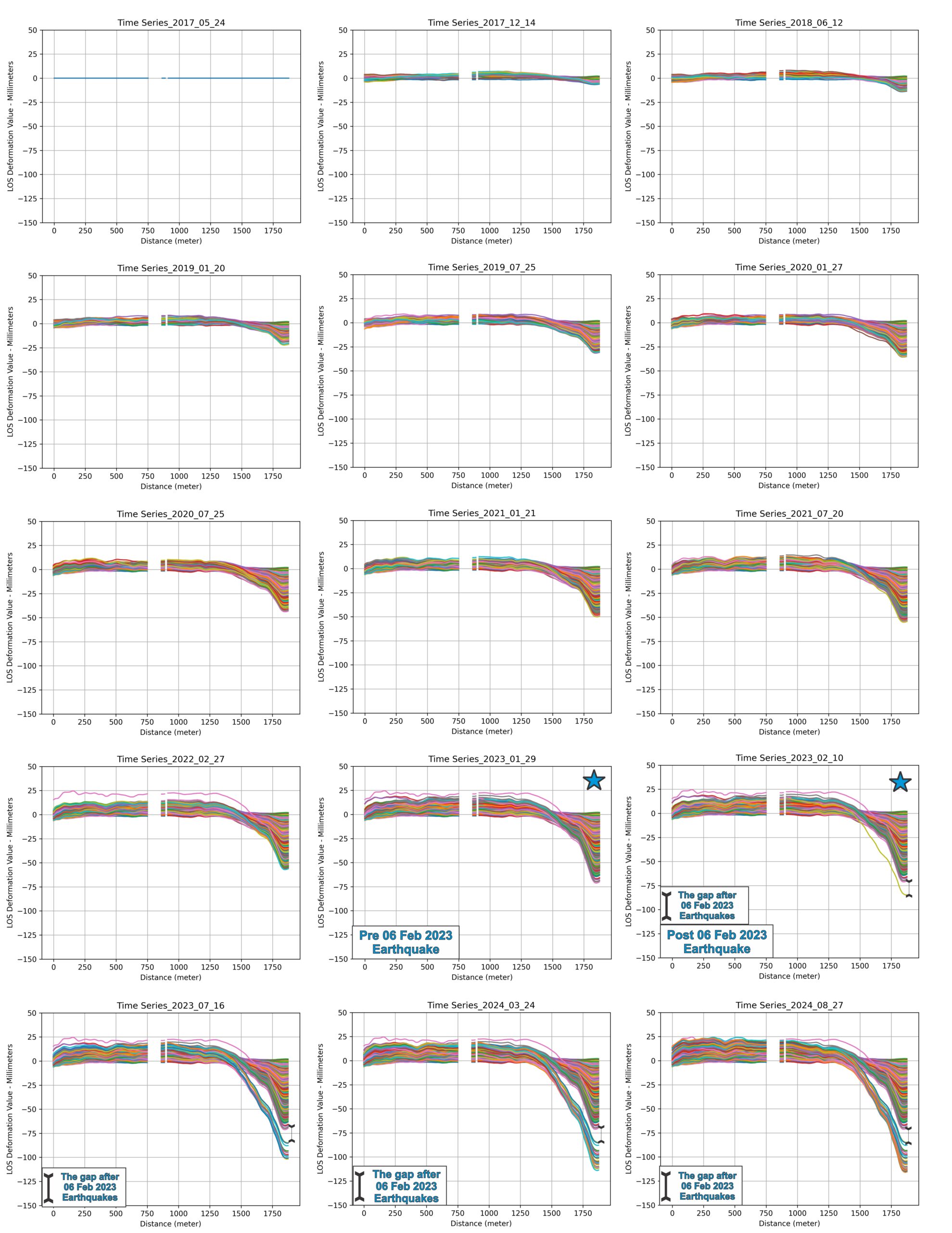
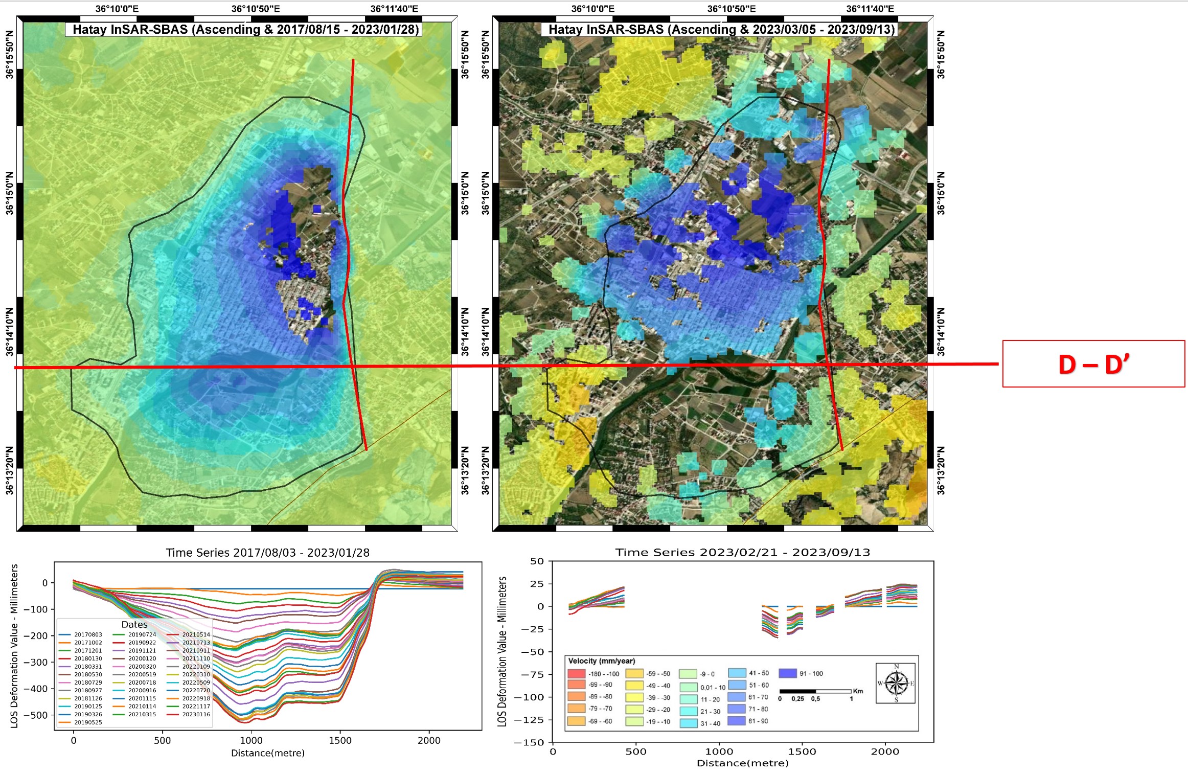
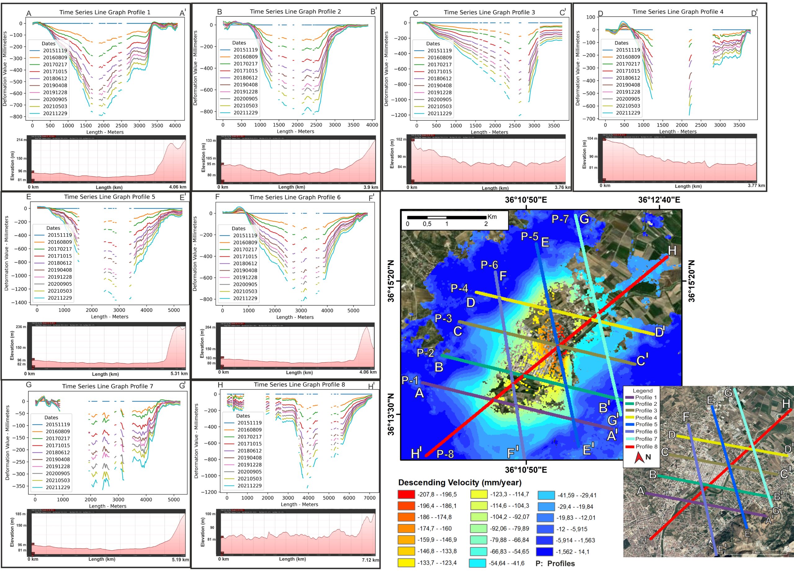
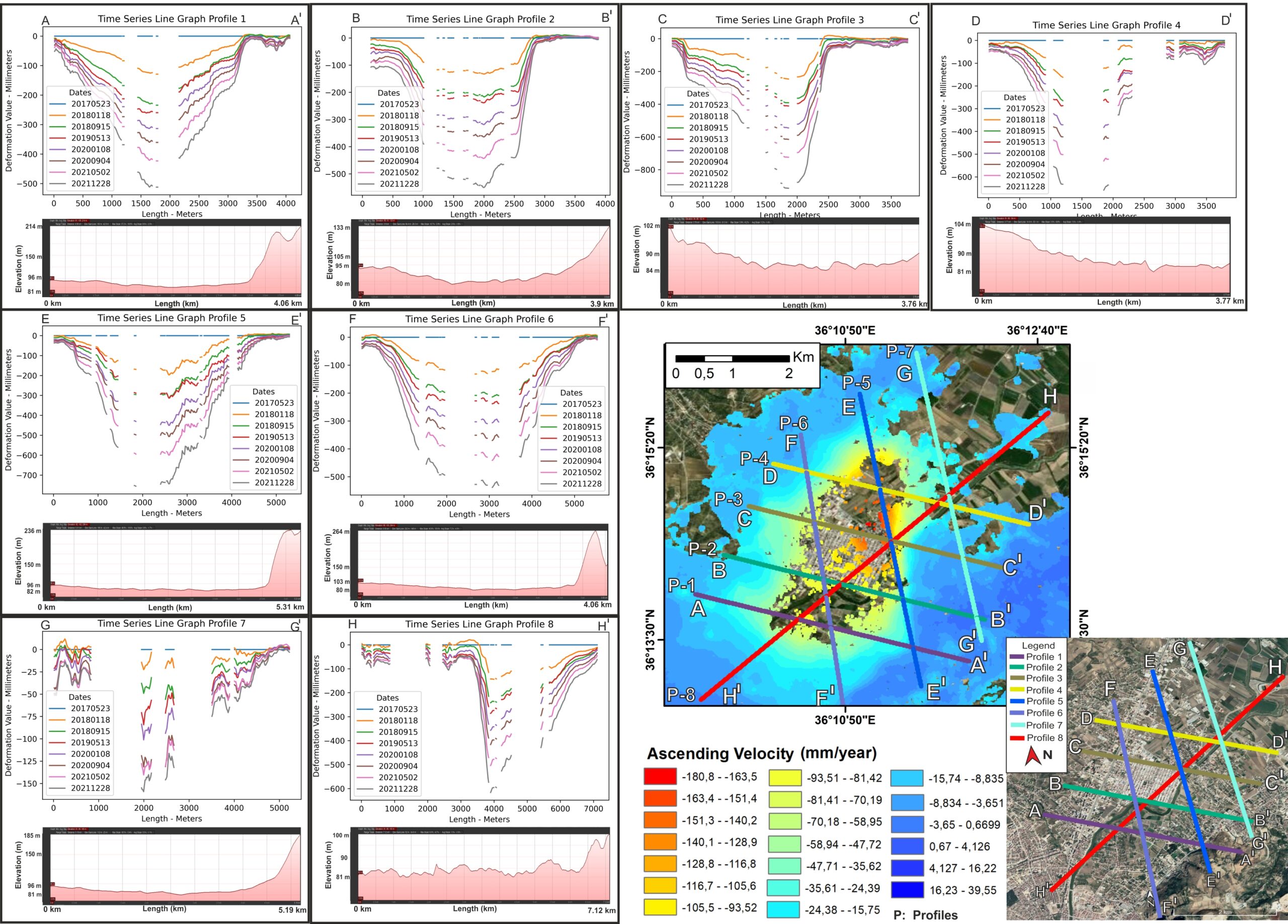
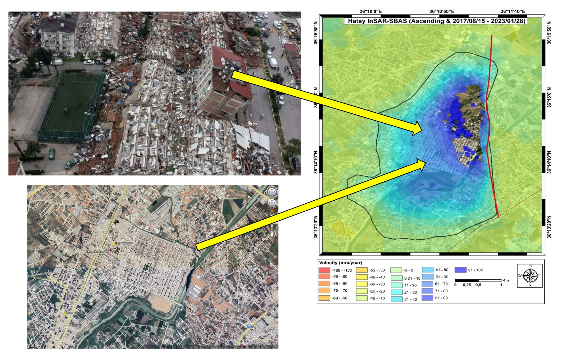
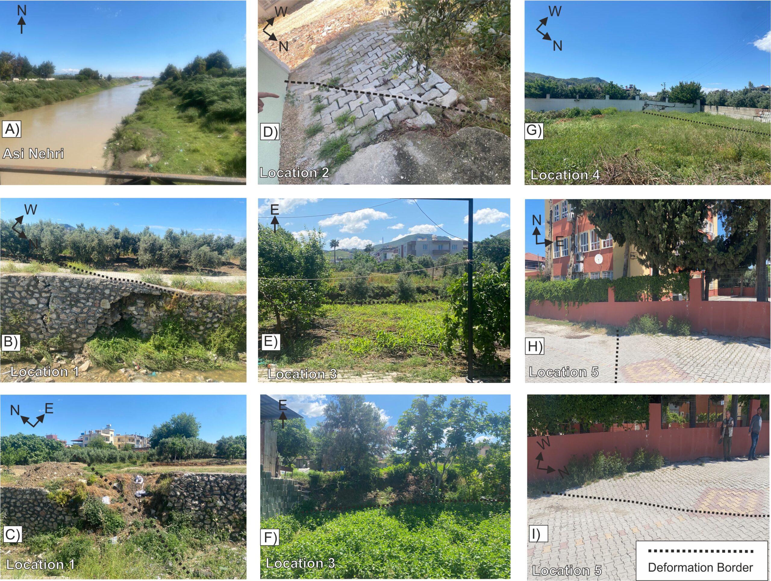
2021-2023    Karaca, Sukru O., Erten G., Ergintav S. and Khan D. Shuhab, 2023. Anthropogenic problems threatening major cities: Largest surface deformations observed in Hatay, Turkey based on SBAS-InSAR (Bulletin of the Mineral Research and Exploration. https://dergi.mta.gov.tr/article/show/2773.html


2022-2023     Karaca, Sukru O., Erten G. 2023. DInSAR and Elastic Dislocation Modelling: A Case Study For The 24 January 2020 Elazig-Sivrice Earthquake, Turkish Journal of Remote Sensing. https://doi.org/10.51489/tuzal.1187819


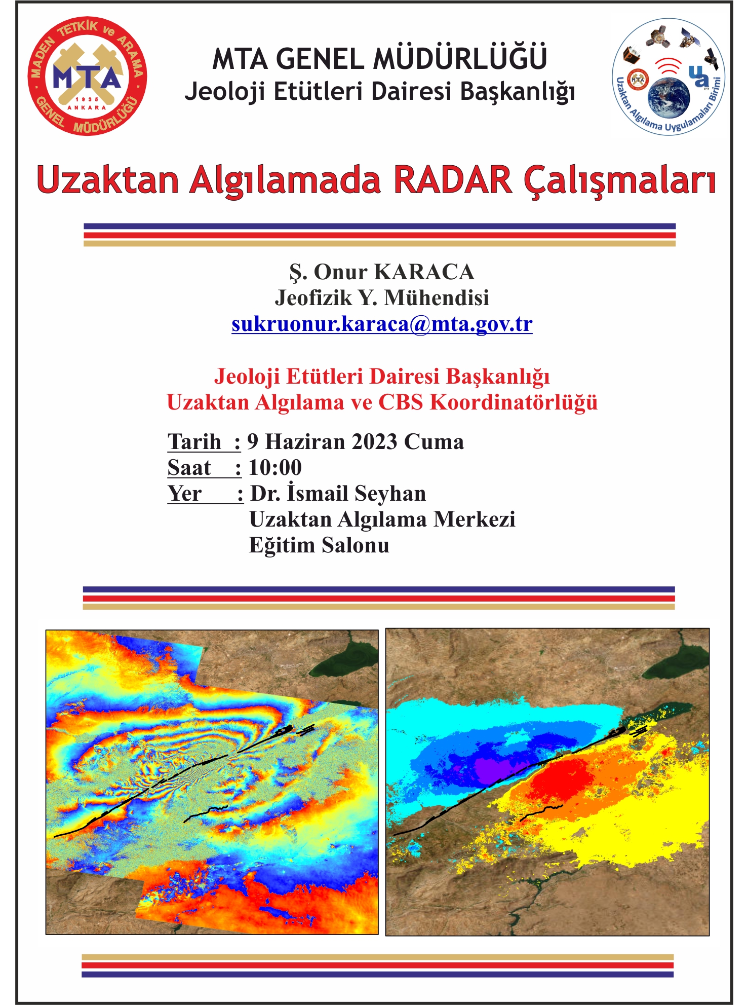
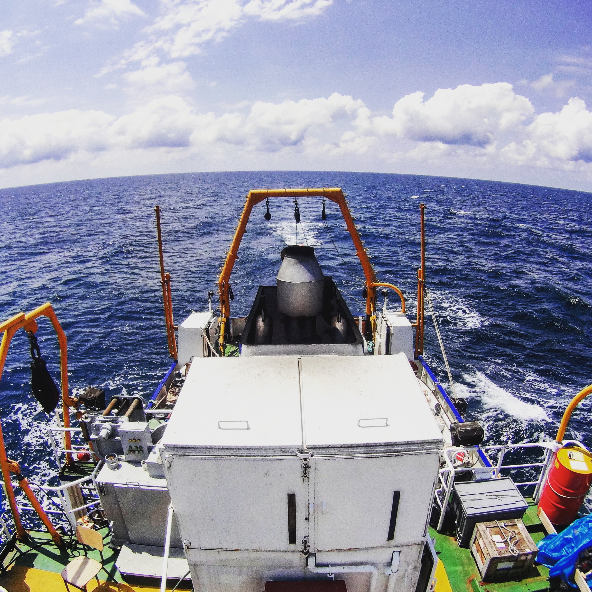
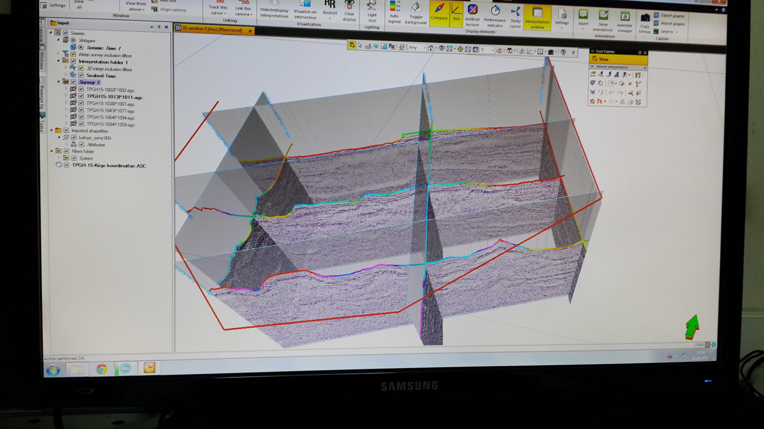
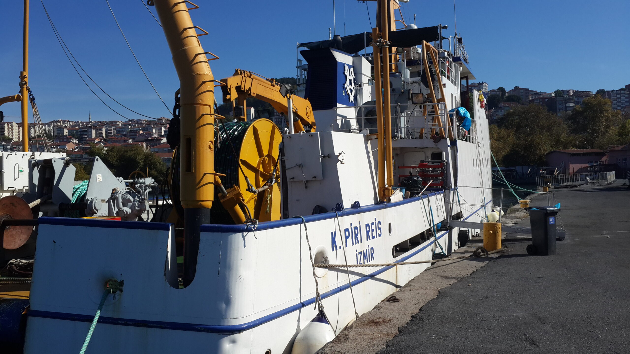
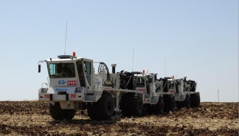
2017-2018      Dondurur D., Karaca O. and Nasıf A., Preliminary Results from Acoustic Survey Offshore Kefken, Southwestern Black Sea Margin, European Geosciences Union General Assembly 2017, 23–28 April, Vienna-Austria http://adsabs.harvard.edu/abs/2017EGUGA..1912036D


2025-2026     Shuhab D. Khan, Michelle Leslie, Aydin Shahtakhtinskiy, Muhammad Younas, Leo Collier, Presley Greer, S. Onur Karaca, Impact of Hurricane Beryl on Texas Coast Beach-Dune Systems: Monitoring Changes via Drone-Based LiDAR and Multispectral Surveys – Science of the Total Environment. https://doi.org/10.1016/j.scitotenv.2025.179319Get rights and content


2025-Present  Muhammad Younas, Shuhab Khan, Osman Tirmizi, S. Onur Karaca, InSAR integrated with geospatial deep learning for land subsidence monitoring in the Gulf Coast of Texas, United States (In Review)

GIS Esri Certificates

 University of Houston – Geographical Information Systems (GIS) Certification

ArcGIS Pro Foundation 2101 

Python Certifiacates

Honors

  • Presidential Fellowship, University of Houston (2024-Present)
  • Teaching Assistant Fellowship at the University of Houston
  • Ministry of National Education Full Scholarship, Turkey (2016-2021)
  • EAS Master’s Excellence Scholarship, University of Houston (2019-2021)
  • First-Class Honors, Master’s Degree, Cukurova University (2012-2015)

Python

90%

Google Earth Engine

90%

HTML

90%

Web Design

90%

ArcPY

90%

Hobbies

When I’m not working, you’ll find me playing guitar, exploring new places with my backpack, or enjoying a game of chess. I also love traveling, trying new outdoor sports — and yes, I’m hooked on pickleball lately!

Contact

Thanks for sending Email!

Processing...